Northern Trip
29 August 2005 - Monday - Continued
We had left Glacier Park, but only because we wanted to go to the
Many Glacier Area which requires leaving the park and driving north
through the Blackfeet Indian Reservation.
We re-entered the park after driving along Lower St. Mary Lake
and Lake Sherburbe, both which were low on water.
Our plan had been to hike to Grinnel Glacier, which is the easiest glacier
in the park to get close to. But unfortunately it was not to be.
The day before a Grizzly Bear mauling happened on that trail, so it
was shut indefinitely. (If it is still early September 2005
you can possibly read a
report on the attack here. Two hikers accidentally startled a mother
near her cubs.)
So we needed a new plan. The ranger suggested a hike to Iceberg Lake, which
was about the same difficulty as Grinnel. But this time of year there
wouldn't be any Icebergs. So we decided to head up that trail and see
what we'd find.
We found a parking space that would stay shady for Susie, and then set off.
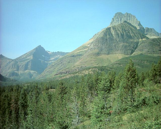
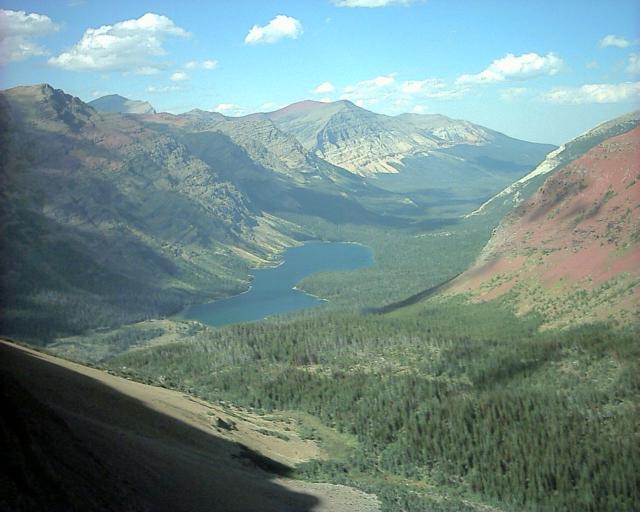
The initial climb was very steep but eventually leveled off. There
were some very pretty views:
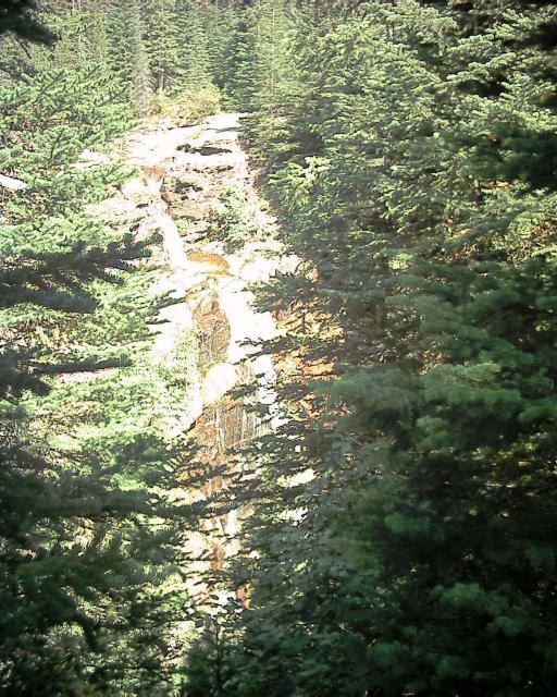
We hiked along a ridge of red rocks, that had impressive amounts of water
gushing from it considering it was the end of summer. And eventually we got
to Ptarmigan Falls:
This was where the trail forked. Should we head to Iceberg Lake?
Then we heard rumors that there was a good view of a glacier if you
hiked the other trail past Ptarmigan Lake and through a tunnel.
It was supposedly steep but worth it.
So I boldly decided to go that way. So Kristina and I hiked. And hiked.
Through forest, along cliffs, along steep inclines up. And up.
We kept being unsure if we should continue, but then we'd pass friendly
old people who would offer encouragement and tell us it was worth it.
And they all looked so energetic, so we couldn't give up.
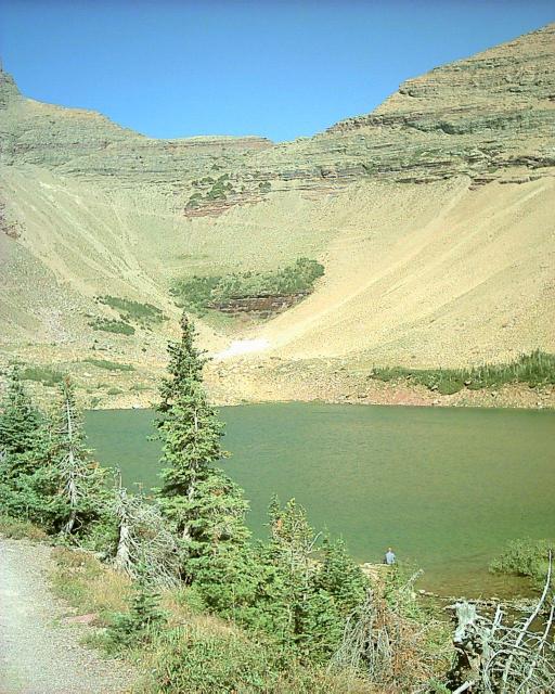
After extreme uphills we finally got to Ptarmigan Lake:
At this point both Kristina and I were extremely tired. And a little
thirsty, as Kristina was severely rationing the water in the camelback
(even though in the end I think we had plenty). If you look at the above
lake picture, notice the switchback that continues on the cliff on the far
side of the lake. About 5/6 of the way up that cliff the trail goes through
a tunnel in the rocks.
We were resting feeling discouraged, when again a troupe of energetic
seniors came down and again encouraged us. So we very slowly began the
ascent. The hiking was a bit difficult as by this point we were 7000
feet high. But we persevered with a lot of breaks, and eventually made it
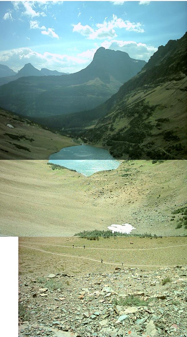
to the top. Here is a panorama looking back:
We arrived at the tunnel suddenly; it was happy as we thought we had more to
climb. I am not sure why the tunnel was dug, or who lugged up the heavy
metal doors that can be used to close it off. But we went through to the
other side. It was amazing how different the land looked on the far side:
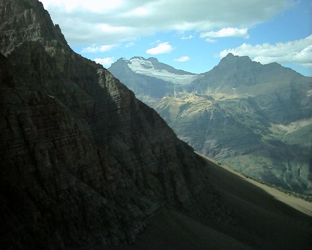
We rested, ate some food, and celebrated being to the top. We then
followed the trail down a bit more so that we could see the glacier spoken
of (we ran into some people who were from either Canada or Alaska and they
had told us "it's an OK glacier, but there are much bigger ones where we're
from"):
We were now at the Northern-most point on our trip, only about 10 miles
south of Canada and the 49th parallel. From now on we were finally heading
back toward home.
So now we returned the way we came, but much faster as it was downhill. We
zoomed down, passing pretty much everyone we had talked to on the way up,
including the orange-shirted guy who had depressed us by jogging up the last
leg that we had barely made it up. There were clouds starting to puff over
the mountains; this was a cold front that we would race the next day.
We made it back to the parking lot around 4:30, having left around noon.
The trail was 5.5 one way, so 11 miles round trip, and it had climbed
2300 feet.
After this I went to get some postcards, and avoided getting any of the
multitude of Huckleberry merchandise that the area was swimming in.
Then we decided to eat at the restaurant at the lodge there. We had pizza
and I got
Huckleberry Cream Soda which was good.
While eating, people in the parking lot kept stopping, staring, pointing,
and using binoculars to look at the mountain behind the lodge. After
eating we went out to ask what the fuss was about. Apparently there was a
grizzly bear walking around up there. Someone let us look through their
telescope and we got to see it. Pretty neat, and nice to see from far away.
I am not sure how anyone noticed it in the first place.
Now it was time to leave the park. We left and the road got super curvy...
moreso than when actually crossing the rockies. We came around a curve and
there were cows standing in the middle of the road. Luckily we were
following someone so we didn't crash into the livestock. The roads at this
point, even the small ones, were labeled "Speed Limit 70 / Night 65".
We caught US 2 over to I-15 via Cut Bank. I-15 in this area was the most
deserted interstate I've ever been on. No one was there. So we traveled
along it until we got to Great Falls, MT. This is named for the Great Falls
of the Missouri River (Lewis and Clark were here) but the river has since
been dammed up and the Great Falls are no more.
We stopped for the night at the Motel 6, and Kristina was so tired she
almost fell asleep while we were checking in. About this time we found out
about Hurricane Katrina devastating the gulf coast... we hadn't been
following the news, the last I had heard of it the storm was a small one
zipping across Florida.
That night we were extremely tired and slept soundly.
306 Miles - Arrived Great Falls Montana
Day 3 - 306 Miles Traveled, 1516 Miles Total
Back to main trip page