Northern Trip
28 August 2005 - Sunday
0 Miles - Left Redmond OR
We woke up at 5:30AM. We took US-97. This area is known as
the "high desert" and parts of it definitely look the part, though other
parts are so irrigated it almost seems like normal farmland.
We crossed the 45th parallel, halfway between the Equator and the North Pole.
We would stay at least this far north until Michigan.
Much of the morning was occupied arguing what the giant mountain out
the window was:
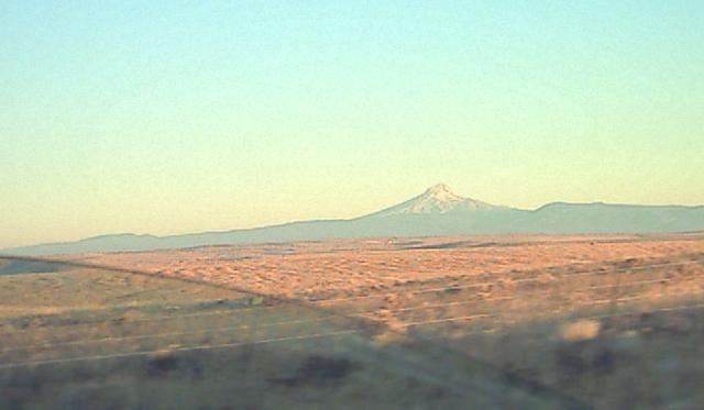
Finally the Oregon Highway Department ended the discussion by having a sign
pointing to that peak and confirming that it was Mount Hood, the
tallest mountain in Oregon. The other peak (not pictured) straight ahead
was Mount Adams in Washington State. Way beyond another peak was jutting
up, I'd like to think it was Mt. Rainier but we never found out.
Speaking of the Oregon Highway Department, they like to have terse signs.
The Speed Limit signs simply say "SPEED 50". To warn of trucks entering a
sign simply says "TRUCKS". So as we were climbing down toward the
Columbia River through a rough lava field littered with boulders
there was simply a sign warning "ROCKS". Very appropriate.
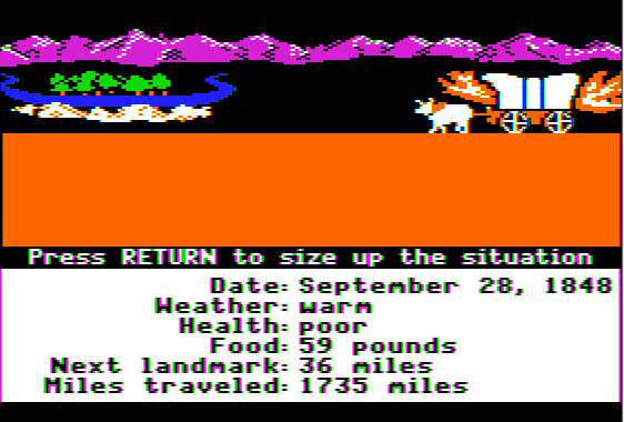
We got to the Columbia just upstream of The Dalles (which means "The Trough"
in French). If you were taking the Oregon Trail this is where you'd attempt
to float your wagon down to the lush part of the valley, rather than the stark
barren cliffs where we were. [Oregon and Washington are lush and green to
the West of the Cascades, but the deserts on the East side are unfortunately
all that we saw on this trip]. Here is about where we were on the trail,
luckily no fires for us!
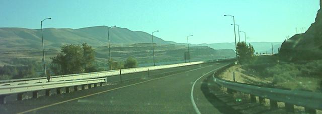
Here is a view of the Columbia River Valley, unfortunately from the highway:
We took I-84 to US-730 and crossed into Washington State.
174 Miles - Arrive Washington State
Washington was dry, yellow, and empty. We decided not to go to Walla Walla
or get any of their famous onions. We pressed onward along 395 to I-90
and eventually arrived at Spokane. There was actually pretty heavy traffic
in Spokane.
389 Miles - Arrive Idaho
Soon after getting to Idaho we stopped for lunch at a small park near
Post Falls. The Spokane River was dammed up there, and there was a nice
picnic area. We took Susie out and let her eat some grass. Unfortunately
yellow jackets harassed us.
We drove by Coeur d' Alene (which means heart of the Awl in French,
referring to the local Indian's trading prowess). There is a very
pretty lake there, supposedly the largest natural freshwater lake west of
the Mississippi. We did not have time to stop, or visit the city's long
floating boardwalk. Here's a picture of the lake:
The road started getting mountainous, and there were finally some trees again
which made us happy.
464 Miles - Arrive Montana
We now entered the Mountain time zone.
We got off I-90 and took tiny roads toward Glacier Park. At first the road
was amazingly pretty, following a wooded river valley with railroad tracks.
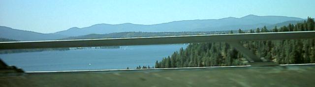
It left this valley and the landscape transitioned to really flat yellow
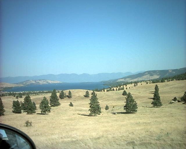
plains. Finally we arrived at Flathead Lake:
We drove around the lake and finally arrived at Kalispell, which is a much
more major town than you'd expect for being in the middle of Montana.
We checked into the Motel 6 and stopped for the day.
Here's a picture of Montana's famed "Big Sky":

All kidding aside, the sky did seem to be a bit more impressive, we never
really came up with a good theory as to why.
625 Miles - Arrived Kalispell Montana
Day 2 - 625 Miles Traveled, 1210 Miles Total
Back to main trip page